Climate Change Indicators: Coastal Flooding
This indicator shows how the frequency of coastal flooding has changed over time.

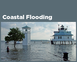
This map shows the average number of days per year in which coastal waters rose above a local threshold for flooding at 42 sites along U.S. coasts. Each small bar graph compares the first decade of widespread measurements (1950–1959 in orange) with the most recent decade (2014–2023 in purple).
Key Points
- Flooding is becoming more frequent along much of the U.S. coastline. Most sites measured have experienced an increase in coastal flooding since the 1950s (Figure 1).
- Over the last decade (i.e., since 2014), Hilo, Hawai‘i, has exceeded the flood threshold most often—an average of 18 days per year—followed by Galveston, Texas, and Sewells Point, Virginia (Figure 1). At more than half of the locations shown, floods are now at least five times more common than they were in the 1950s.
- The average number of flood events per year has progressively accelerated across decades since 1950. The rate of increase of flood events per year is the largest at most locations in Hawai‘i and along the East and Gulf Coasts (Figure 2).
- Flooding has increased less dramatically in places where relative sea level has not risen as quickly as it has elsewhere in the United States (as shown by the Sea Level indicator). Two sites in Alaska and three sites along the West Coast have experienced a decrease in coastal flooding (Figures 1 and 2), coinciding with decreasing relative sea level as the land itself is rising.
Background
Changing sea levels are affecting human activities in coastal areas. Rising sea level inundates low-lying wetlands and dry land, erodes shorelines, contributes to coastal flooding, and increases the flow of salt water into estuaries and nearby groundwater aquifers. Higher sea level also makes coastal infrastructure more vulnerable to damage from storms.
“Relative sea level change” refers to the height of the ocean relative to the land at a particular location. As relative sea level rises due to climate change (see the Sea Level indicator), one of the most noticeable consequences is an increase in coastal flooding. Flooding typically occurs during seasonal high tides (“king tides”) and storms that push water toward the shore. In recent years, however, coastal cities are increasingly flooding on days with less extreme tides or little wind, even on sunny days. Floods are happening more often as rising sea level reduces the gap between average sea level and the height of the land. This type of tidal flooding is expected to increase in depth, frequency, and extent in the United States during this century.1
Many coastal cities have defined “nuisance” flooding (also referred to as high tide flooding) thresholds. When water rises above this level, minor impacts from flooding typically occur in some streets, many storm drains become ineffective, and a coastal flood advisory may be issued. Recurrent coastal flooding can cause impacts such as frequent road closures, reduced stormwater drainage capacity, and deterioration of infrastructure not designed to withstand frequent inundation or exposure to salt water. These impacts are of particular concern because more than 40 percent of Americans live near the coast, and more than $1 trillion of property and structures is at risk.2,3 Coastal flooding can also affect human health—for example, by increasing the risk that wastewater infrastructure will fail, putting people at risk of being exposed to pathogens and harmful chemicals.1
About the Indicator
This indicator tracks coastal flooding based on measurements from tide gauges at locations along U.S. coasts. These devices measure water levels continuously, which makes them ideal for measuring the height of the tides, tracking long-term local relative sea level rise, and detecting coastal floods. This indicator focuses on 42 tide gauges where complete data are available from 1950 to present. The indicator tracks the number of days per year when each tide gauge measured water that was higher than a local flooding threshold determined by the National Oceanic and Atmospheric Administration (NOAA). Figure 1 shows the 42 stations on a map and compares the first and last decades of data, while Figure 2 provides a more detailed comparison using all years of data since 1950.
About the Data
Indicator Notes
Flood thresholds for this indicator are defined based on a statistical approach that accounts for typical local fluctuations in the tides. This method is useful because it allows scientists to calculate a flood threshold for any location along the coast, as long as enough years of data have been collected. However, these flood thresholds do not necessarily correspond to a specific level of observed disruption or damage. Every city is unique in terms of land cover, topography, locations of roads and other infrastructure (how close they are to sea level), and the presence of flood defenses such as seawalls. As a result of these differences, high tide flooding that reaches the threshold in one city might only cause a minor inconvenience for a few people, while waters that reach the threshold in another city might flood large sections of a low-lying downtown area. For this reason, when considering the impacts of flooding, it is more useful to compare change over time at a single location than it is to compare patterns across different locations.
This indicator is limited to tide gauges with several decades of data. These tide gauges tend to be clustered along the East Coast, particularly in the Mid-Atlantic region. Other parts of the U.S. coast have fewer tide gauges with long-term data.
Data Sources
This indicator is based on hourly water level data that are publicly available from NOAA at: https://tidesandcurrents.noaa.gov, and it uses methods and flood thresholds developed by NOAA.6,7
Technical Documentation
References
1. May, C. L., Osler, M. S., Stockdon, H. F., Barnard, P. L., Callahan, J. A., Collini, R. C., Ferreira, C. M., Finzi Hart, J., Lentz, E. E., Mahoney, T. B., Sweet, W., Walker, D., & Weaver, C. P. (2023). Chapter 9: Coastal effects. In USGCRP (U.S. Global Change Research Program), Fifth National Climate Assessment. https://doi.org/10.7930/NCA5.2023.CH9
2. USGCRP (U.S. Global Change Research Program). (2018). Impacts, risks, and adaptation in the United States: Fourth National Climate Assessment, volume II (D. R. Reidmiller, C. W. Avery, D. R. Easterling, K. E. Kunkel, K. L. M. Lewis, T. K. Maycock, & B. C. Stewart, Eds.). https://doi.org/10.7930/NCA4.2018.RiB
3. USGCRP (U.S. Global Change Research Program). (2023). Fifth National Climate Assessment (A. R. Crimmins, C. W. Avery, D. R. Easterling, K. E. Kunkel, B. C. Stewart, & T. K. Maycock, Eds.). https://doi.org/10.7930/NCA5.2023
4. NOAA (National Oceanic and Atmospheric Administration). (2024). Tides and currents: CO-OPS derived product API [Data set]. https://api.tidesandcurrents.noaa.gov/dpapi/prod
5. NOAA (National Oceanic and Atmospheric Administration). (2024). Personal communication: Alaska site data, 1950–2023.
6. Sweet, W. V., Dusek, G., Obeysekera, J., & Marra, J. J. (2018). Patterns and projections of high tide flooding along the U.S. coastline using a common impact threshold (NOAA Technical Report NOS CO-OPS 086). NOAA/NOS Center for Operational Oceanographic Products and Services. https://tidesandcurrents.noaa.gov/publications/techrpt86_PaP_of_HTFlooding.pdf
7. Sweet, W. V., Hamlington, B. D., Kopp, R. E., Weaver, C. P., Barnard, P. L., Bekaert, D., Brooks, W., Craghan, M., Dusek, G., Frederikse, T., Garner, G., Genz, A. S., Krasting, J. P., Larour, E., Marcy, D., Marra, J. J., Obeysekera, J., Osler, M., Pendleton, M., … Zuzak, C. (2022). Global and regional sea level rise scenarios for the United States: Updated mean projections and extreme water level probabilities along U.S. coastlines (NOAA Technical Report NOS 01). National Oceanic and Atmospheric Administration. https://oceanservice.noaa.gov/hazards/sealevelrise/sealevelrise-tech-report.html
Learn about other indicators in this section